
Participation of the members of the Polish CAA Chapter at the international conference Computer Applications and Quantitative Methods in Archaeology (CAA) in Amsterdam, 2-6 April 2023
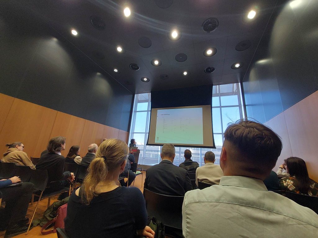
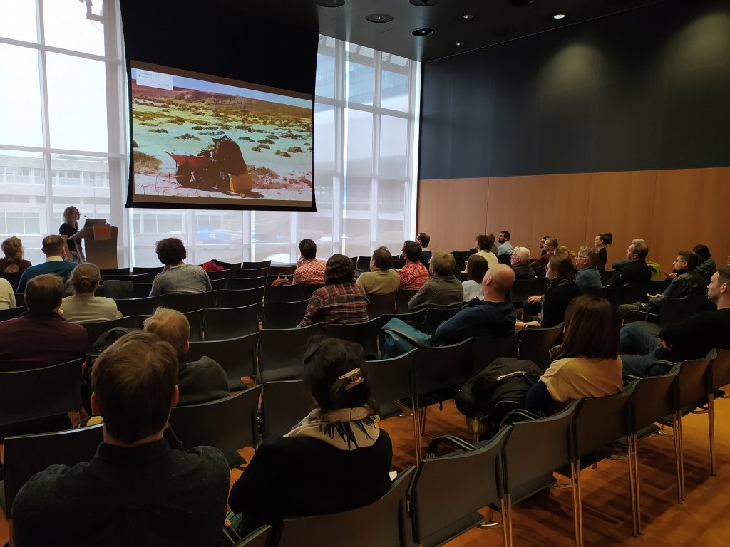
From April 2nd to April 6th, 2023, the 50th International Conference on Computer Applications and Quantitative Methods in Archaeology was held in Amsterdam. A total of 41 sessions were held during the CAA conference, including 318 presentations and 21 posters. The conference proceedings lasted for three days and were preceded by workshops on various computer techniques, GIS, and issues related to the documentation of archaeological heritage:
- Basic tools and software: QGIS (basic level), GitHub
- Field documentation of archaeological heritage: Field
- 3D: Blender, GigaMesh, data publishing
- Artificial intelligence: introduction to deep learning
- Agent-based modelling
- F.A.I.R.
The sessions organised were very diverse, with a predominance of topics related to machine learning, 3D, the use of unmanned aerial vehicles, and agent-based modelling.
In addition, the conference included an intensive course on computer methods in Archaeology – CAA Computational Archaeology Lab (CAL)
CAA Polish chapter
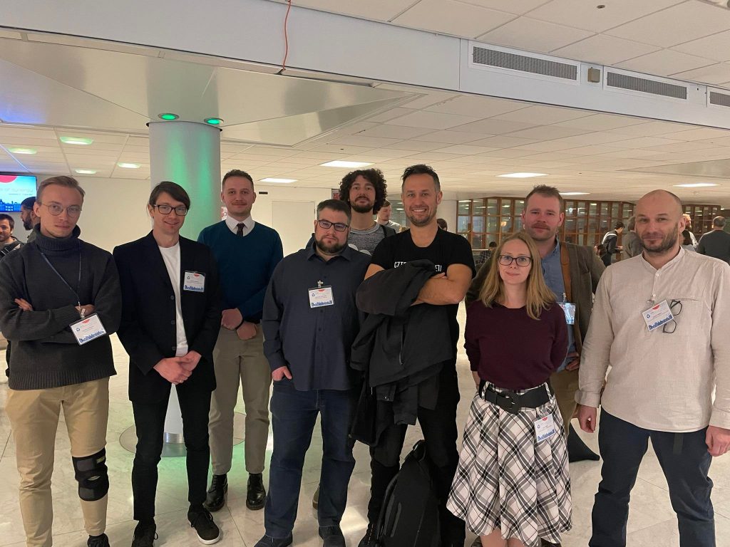
Members of the Polish CAA who attended the CAA conference in Amsterdam
- Adrian Chlebowski
- Jakub Stępnik
- Joachim Martecki
- Julia Chyla
- Kamil Kopij
- Łukasz Miszk
- Maciej Krawczyk
- Maria Legut Pintal
- Nazarij Buławka
- Paweł Lech
- Robert Mahler
- Sylwia Buławka
- Szymon Jellonek
- Wojciech Ostrowski
Referaty
DAISY 2.0: A field database solution for an archaeological institution
Authors: Adrian Chlebowski (The Polish Centre of Mediterranean Archaeology, University of Warsaw ); Maciej Krawczyk (Faculty of History, University of Warsaw); Robert Mahler (Polish Centre of Mediterranean Archaeology, University of Warsaw)*
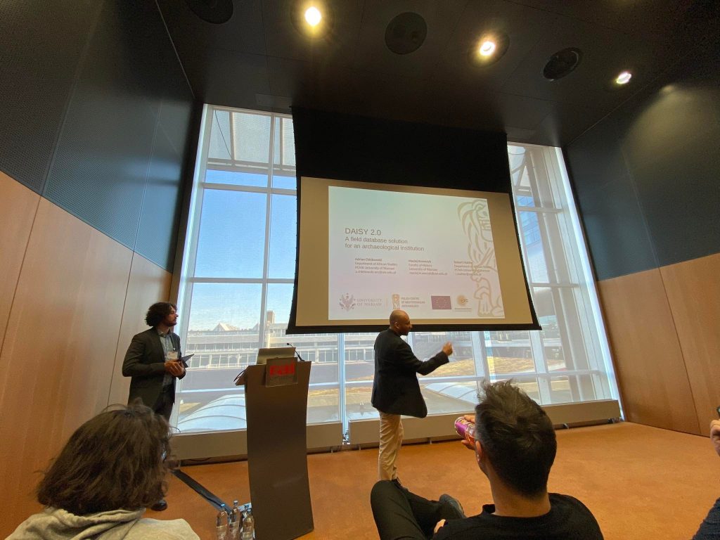
While there are a wide variety of digital databases available out there, the specificity of the
Polish Centre of Mediterranean Archaeology (PCMA) and its expeditions have called for a
dedicated approach. The Digital Archaeological Information System (DAISY) was created
for the UMMA ERC Old Dongola archaeological project to facilitate the in-the-field collection of archaeological data. A second version of the database was built from scratch – with three
main principles being brought to the forefront, namely: simplicity, flexibility, and two-way
communication with GIS. Built around the central PostgreSQL server and a browser client
the database is intended to be easily applicable to other archaeological projects.
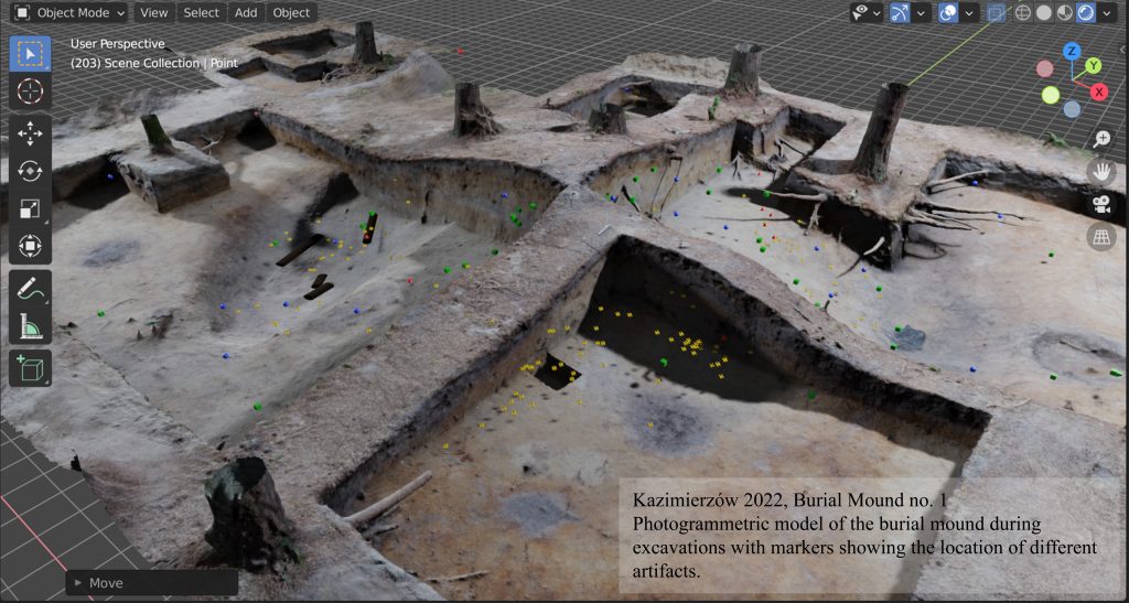
Photogrammetric documentation in 3D analysis of an Early Medieval burial mound in Kazimierzów, Poland.
Author: Jakub Stępnik (Institute of Archaeology, Jagiellonian University)
During the 2023 CAA conference in Amsterdam, Jakub Stępnik presented a 3D database created for the Chodlik Archaeological Mission. He has transferred all the photogrammetrical models, including each exploration level, to Blender®, creating a tool to store the data and allow the basis for 3-D analysis of layers and planigraphy. This is a simple way for more precise and efficient work to prepare site reports or context sheets. But most of all, it enables the team to go back in time to a certain moment of excavations, reanalyze undertaken actions, and reinterpret the layers using the knowledge we have gathered. Jakub Stępnik and Łukasz Miechowicz, PhD have developed a workflow for burial mound excavations that allows faster fieldwork and more precise data gathering, which also limits the use of a total station since the points are gathered directly from the photogrammetry. Yet, one of the biggest advantages is the simplicity of creating the database, where the software is free, and since photogrammetry became a standard, it is just one step forward.
Typology of MobileGIS workflow in archaeological prospection: Crowd Data Collection, Volunteer Geographic Information or Geographic Citizen Science?
Authors: Julia M. Chyla (Faculty of Archaeology, University of Warsaw)*; Miłosz Giersz (Faculty of Archaeology, University of Warsaw)
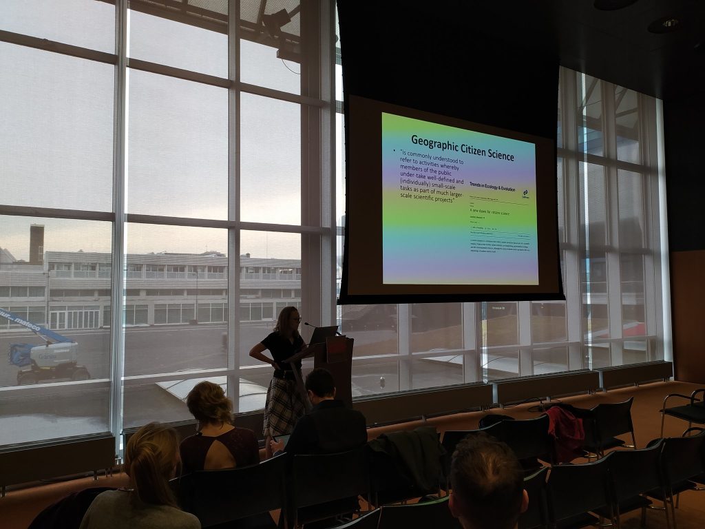
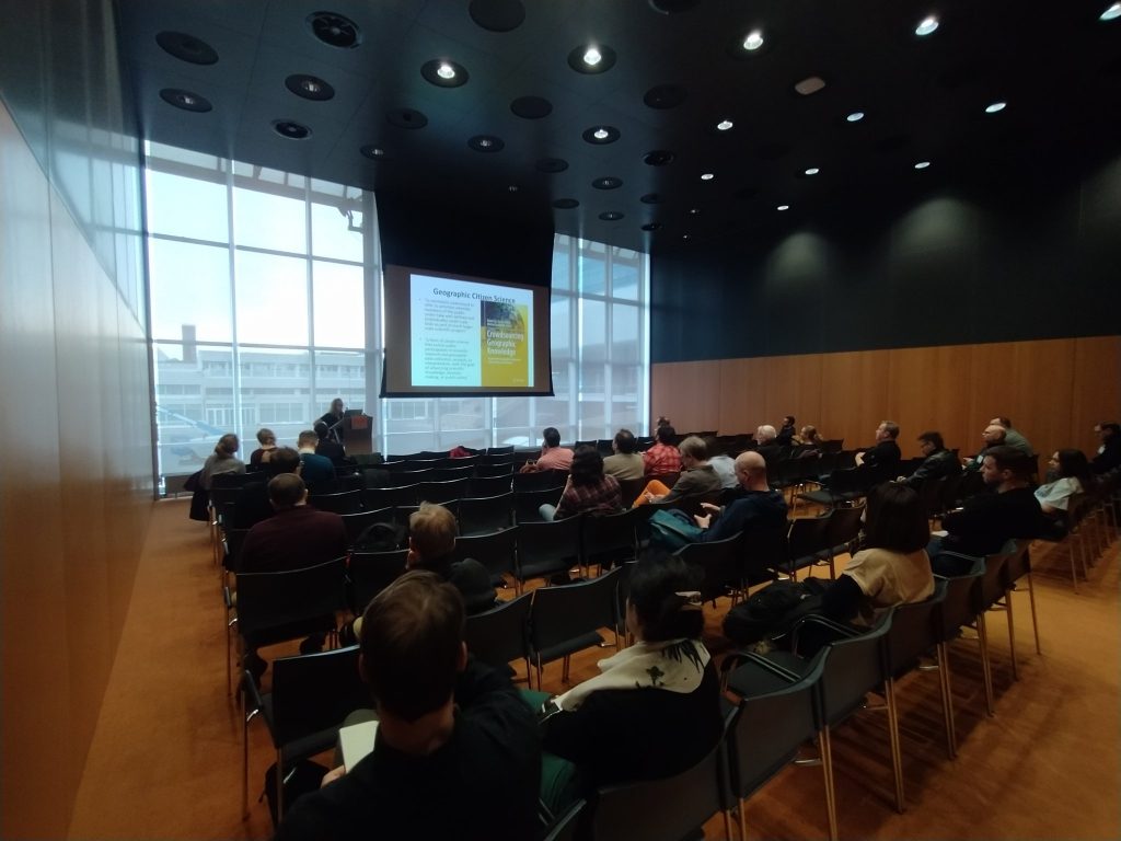
The presentation focused on the theoretical aspect of using mobile GIS in archaeological field prospection. The mobile version of Geographical Information Systems allows rapid data collection by multiple users simultaneously. However, to date, neither a methodology nor a workflow before, during and after field surveys using this method has been proposed. In this presentation, we not only discussed the theoretical aspect of Mobile GIS, but also discussed the proposed definitions and methodological typologies related to Crowd Data Collection, Volunteer Geographic Information and Geographic Citizen Science from an archaeological research perspective.
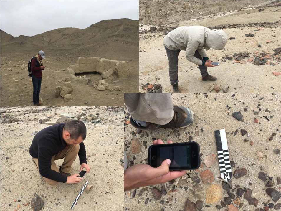
(Reading) African Palimpsest – the use of mobileGIS for a team based collaboration: the case study of the rural hinterland of Mustis (Tunisia)
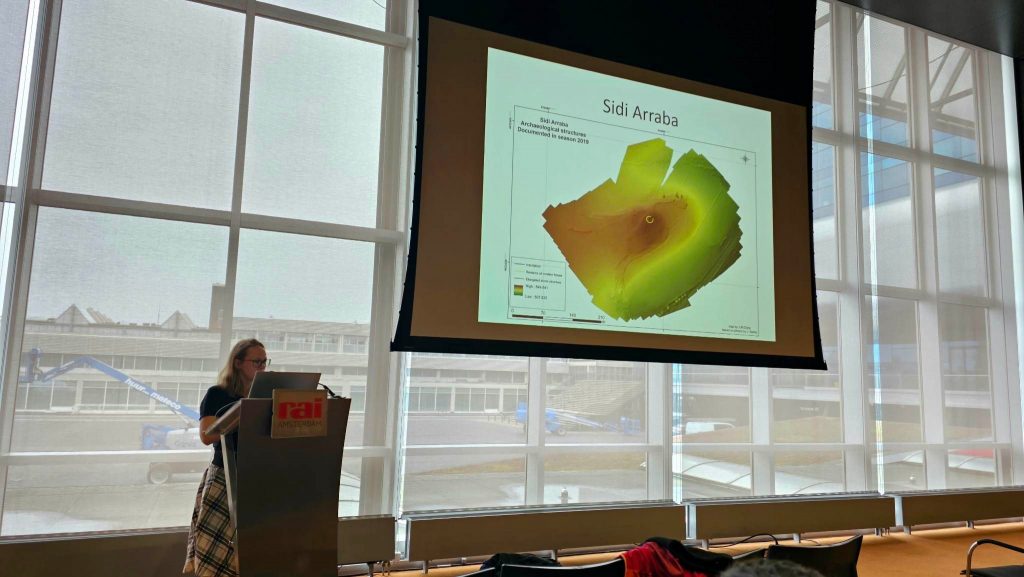
Authors: Julia M. Chyla (Faculty of Archaeology, University of Warsaw); Tomasz Waliszewski (University of Warsaw)*; Jamel Hajji (The National Heritage Institute, Tunisia); Faouzi Ghozzi (The National Heritage Institute, Tunisia); Ewa Smolska (Faculty of Geography and Regional Studies, University of Warsaw); Jerzy Lechnio (Faculty of Geography and Regional Studies, University of Warsaw); Piotr Szwarczewski (Faculty of Geography and Regional Studies, University of Warsaw); Ouadii El Aroui (CGMED Laboratory, FSHS Tunis, University of Tunis); Piotr Makowski (Institute of Archaeology, Jagiellonian University); Krzysztof Misiewicz (Uniwersytet Warszawski); Radosław Mieszkowski (Faculty of Geology, University of Warsaw); Adrian Ochtyra (Faculty of Geography and Regional Studies, University of Warsaw); Chokri Touihri (Institut National du Patrimoine); Paweł Rongies (Faculty of Archaeology, University of Warsaw); Konstanty Kowalewski (Faculty of Archaeology, University of Warsaw)
One of the main goals of the Mustis Archaeological Project is to investigate the dynamics of spatial transformation of the rural hinterland of the Mustis archaeological site (northern Tunisia). To grasp the tangible picture of long-term evolution of the cultural landscape an interdisciplinary approach combining archeological, geomorphological and geophysical methods has been applied. Various data yielded during such a wide range collaboration require a proper management and integration which was provided by the implementation of mobileGIS.
The process of investigation started with an analysis of satellite images and archival maps. Importantly, the purpose of this activity was to mark not only archaeological, but also geomorphological areas of interest. These initial assessments were later verified during the field reconnaissance using the mobileGIS tools like: Survey123, Tracer and Field Maps. To supplement the overall view during the prospection, the surveyors collected geomorphological samples and documented the most distinctive archaeological structures visible on the surface. Finally, the attention was paid on a detailed, artifact-oriented field prospection and geophysical survey of Sidi Araba – a well-preserved rural settlement located in the close proximity of Mustis. After the completion of field works, the collected material was further documented and analyzed by specialists and later uploaded to already existing mobileGIS datasets. Yielded data were finally implemented into the joined online GIS shared by all members of the project.
This paper aimed to present how the mobileGIS application can function as a useful tool for collecting different type of data. After the completion of field works, all members of the team have a constant access and opportunity to analyze and edit the shared data yielded by various specialists working within the project. Our intention was to demonstrate not only survey itself, but also pre- and post-field work procedures of data processing. This point is particularly important one, while until now the discussion concerning the mobileGIS has been focused mostly on the data collection process itself. All these aspects can finally help us to define the successful guidelines for preparation, presentation and publication of the datasets.
Best of both worlds: Visibility analysis of objects of different sizes based on algorithms and experimental studies
Authors: Kamil Kopij (Institute of Archaeology, Jagiellonian University)*; Kaja Głomb (Institute of Applied Studies, Jagiellonian University)
The well-known saying “Garbage In, Garbage Out” states that the quality of the result depends on the quality of the input data. The result will also be incorrect or meaningless if the input data is incorrect or meaningless. In his presentation, Kamil Kopij compared the results of analyzing the visibility of hand gestures based on the currently used algorithms that determine the maximum distance at which objects of different sizes are visible with the results obtained based on experimental data. The comparative analysis demonstrated the inadequacy of commonly used algorithms for analyzing the visibility of a human silhouette, including their gestures and facial expressions.
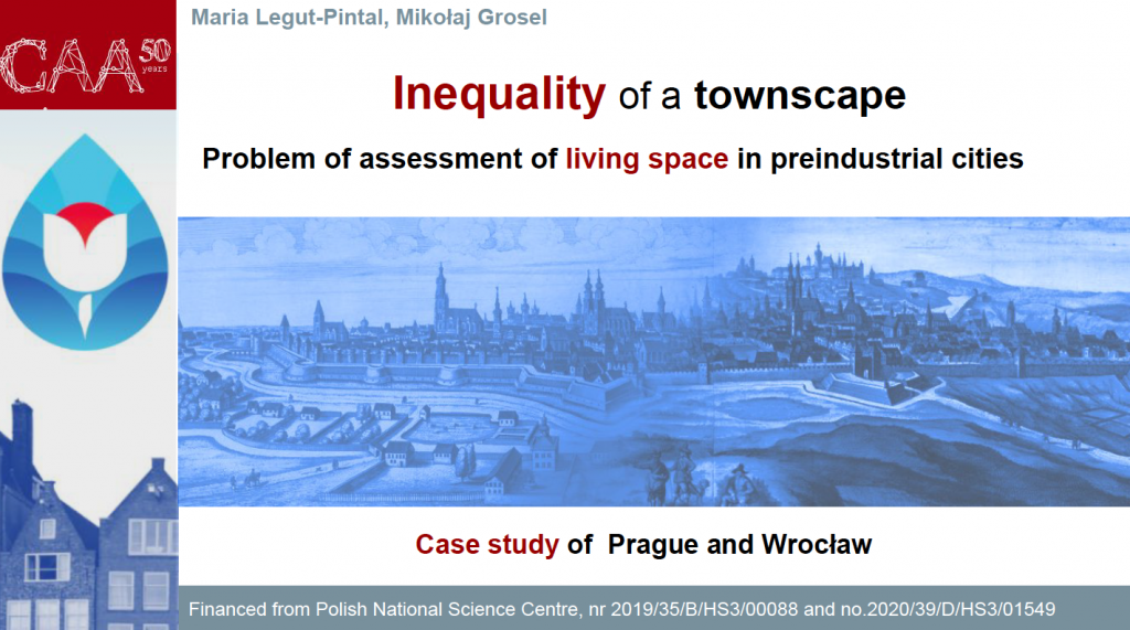
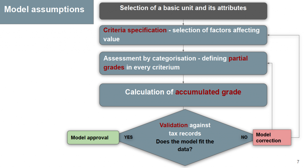
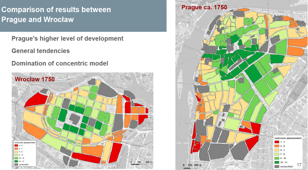
Inequality of a townscape. Problem of assessment of living space in preindustrial cities
Authors: Maria M. Legut-Pintal (Institute of Archaeology – University of Wroclaw)*; Mikołaj Grosel (Wrocław University of Science and Technology)
Created by Maria M. Legut-Pintal
In the presentation, Maria Legut-Pintal proposed a method for assessing the utility value of living spaces based on contemporary methods used in real estate appraisal. The approach of her team is based on a scoring method that combines quantitative and qualitative elements. The methods combine iconographic, cartographic, and archaeological data, as well as historical sources and architectural documentation, to assess living spaces. The team conducted analyses using GIS tools, and compared the results with tax sources and real estate prices. Maria Legut-Pintal presented the method using the examples of Wrocław and Prague in the 28th century, which allowed to identify prestigious and degraded areas in the city.
Maria Legut-Pintal (by Łukasz Miszk)
Near East irrigation studies beyond SRTM and CORONA. Preliminary results of the UnderTheSands project
Authors: Nazarij Bulawka (Landscape Archaeology Research Group, Catalan Institute of Classical Archaeology)*; Hector A. Orengo (Landscape Archaeology Research Group, Catalan Institute of Classical Archaeology)
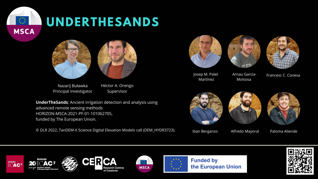
The presentation introduced the objectives and preliminary results of the MSCA UnderTheSands project carried out at the Catalan Institute of Classical Archaeology in Tarragona and funded by the European Union (UnderTheSands. Ancient irrigation detection and analysis using advanced remote sensing methods. HORIZON-MSCA-2021-PF-01. N. 101062705).
The project is dedicated to studying ancient irrigation networks in the Middle East using remote sensing, machine learning, and deep learning techniques.
MA-P vs. Arches. An open source data management platform for MA-P (“Maloutena and Agora in the layout of Paphos: modeling the cityscape of the Hellenistic and Roman capital of Cyprus”) project (Nea Paphos, Cyprus)
Authors: Pawel Lech (Polish Centre of Mediterranean Archaeology)*; Łukasz Miszk (Institute of Archaeology, Jagiellonian University); Wojciech Ostrowski (Warsaw University of Technology)
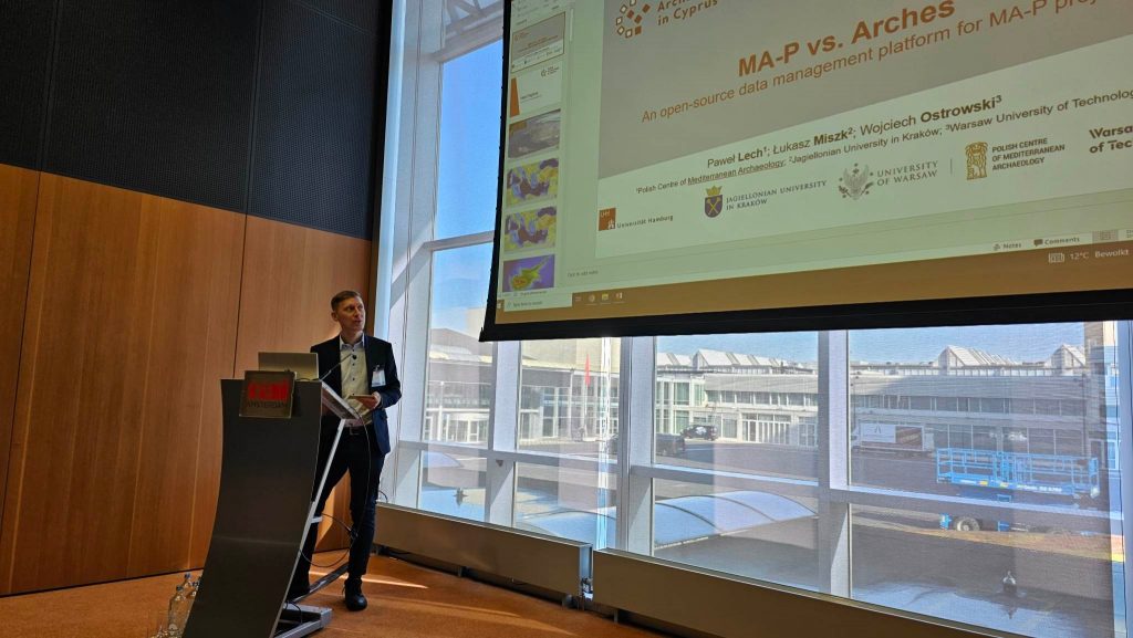
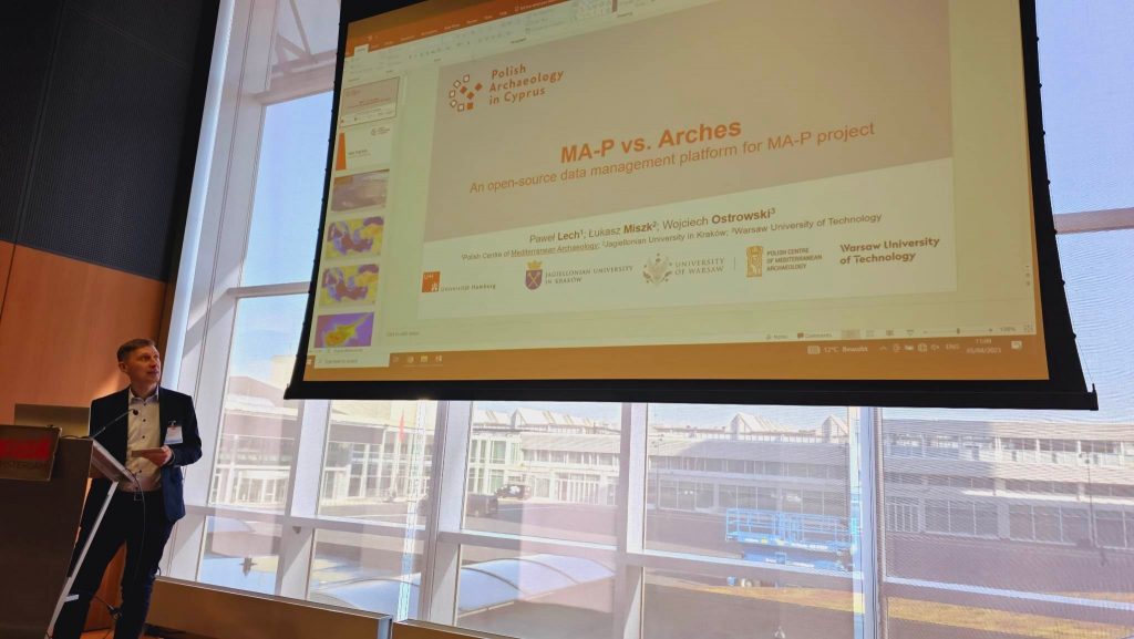
Presentation of Paweł Lech, Łukasz Miszk and Wojciech Ostrowski focused on the experiences related to implementing a database solution based on the Arches framework created by The Getty Institute. Starting in 2020, the MA-P Maloutena and Agora in the layout of Paphos: modeling the cityscape of the Hellenistic and Roman capital of Cyprus project, under the direction of Prof. E. Papuci-Władyka (UJ, UW), faced the issue of finding the best data organization solution for a large interdisciplinary team working in the field. After analyzing many available solutions, we decided to implement the Arches platform. Our experiences with the solution offered by The Getty Institute were the subject of our discussions at the CAA conference
The bonestatr: An R package to facilitate choosing the best human stature reconstruction method based on bones
Authors: Robert Mahler (Polish Centre of Mediterranean Archaeology, University of Warsaw)*
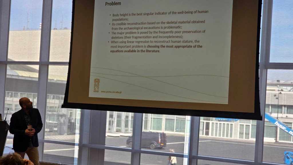
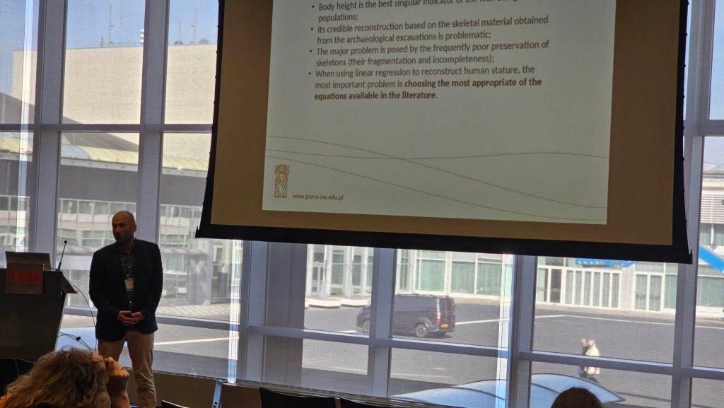
The bonestatr is an R package intended to facilitate the process of choosing the best stature reconstruction method for human skeletal populations in the case of very incomplete skeletal series, which is the most commonly encountered in archaeological practice. It is hoped that such R automation
support in the analysis, not requiring good bone preservation, will encourage researchers
to use a more formal way of selecting the stature reconstruction formulae in everyday
practice. The bonestatr is an R implementation of the procedure published by the author in
Archaeometry (vol. 64, pp. 265–280).
Excavation Databases and Numismatic Needs: Case of Marea Archaeological Project
Authors: Szymon P Jellonek (University of Warsaw)*; Barbara Zając (National Museum in Kraków)
The presentation discusses the problems encountered during the preparation of a database for an archaeological project in Mareia, which has collected 8000 coins dated from the Hellenistic period to the Umayyad period.
Postery
Photogrammetric terrain model of the San Isidro site in El Salvador. Data processing and archaeological analysis
Authors: Joachim Martecki (Faculty of Archaeology, University of Warsaw)*
Joachim Martecki, a fourth-year student at the Faculty of Archaeology of the University of Warsaw – involved in the research of the Proyecto Arqueologico San Isidro of the University of Warsaw conducted in El Salvador.
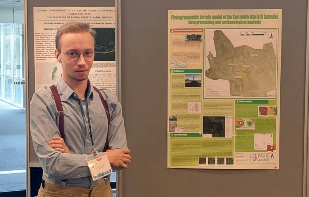
The poster presents a photogrammetric terrain model of the San Isidro site. The author described the process of creating and analyzing the model, dividing it into three stages: fieldwork and unmanned aerial vehicle (UAV) survey; selection and processing of acquired data and compilation of the model; and finally, the methodology of developing the model for searching preserved architectural structures and other spatial analyses. Each stage was thoroughly described with a considerable amount of technical details. The author emphasized the special working conditions in El Salvador and their impact on the entire process. In addition, basic information about the project was included.
The poster received much attention both for the methods used and for the project in El Salvador itself.
The preliminary results of application of remote sensing and machine learning methods in the studies of flint mining landscape in Egypt
Authors: Sylwia Buławka (Institute of Archaeology and Ethnology of Polish Academy of Sciences)*; Nazarij Bulawka (Landscape Archaeology Research Group, Catalan Institute of Classical Archaeology)
The poster presents preliminary results of the application of the deep learning to detect flint mines in two test areas in Egypt. Free high-resolution satellite images were used in the project. The model was trained using YOLOv5. In addition, the analysis was preceded by landscape studies using vegetation and soil indexes calculated based on multispectral Sentinel 2 images.
Buławka, N., Buławka, S., Chlebowski, A., Chyla, J. M., Jellonek, S., Kopij, K., Krawczyk, M., Lech, P., Legut-Pintal, M., Mahler, R., Martecki, J., Miszk, Ł., Ostrowski, W., & Stępnik, J. (2023, April 26). Participation of the members of the Polish CAA Chapter at the international conference Computer Applications and Quantitative Methods in Archaeology (CAA) in Amsterdam, 2-6 April 2023. CAA Poland. Computer Applications and Quantitative Methods in Archaeology. https://pl.caa-international.org/en/caa-2023-ams-caapl-team-en/
Last modified: 2023-04-26